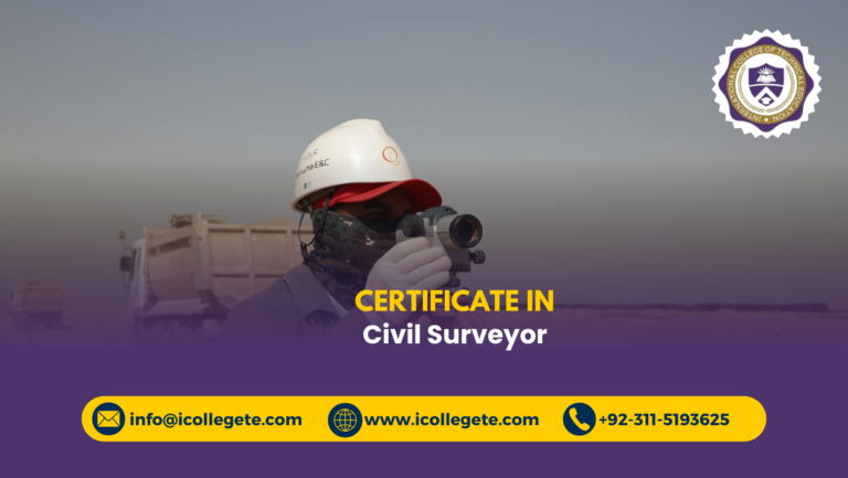
The Civil Surveyor Course in Rawalpindi is a specialized training program designed to equip learners with the technical skills and practical knowledge required to measure, map, and analyze land for construction, development, and engineering projects. As urban expansion and infrastructure demands grow across Pakistan and the Gulf region, the need for Civil Surveyor Course in Rawalpindi who can deliver accurate data and support project planning has never been greater.
Civil Surveyor Course in Rawalpindi offers a structured curriculum that blends theoretical instruction with hands-on fieldwork. Participants learn to operate surveying instruments such as theodolites, total stations, GPS devices, and leveling tools. Key topics include topographic surveying, geodetic principles, contour mapping, and boundary demarcation. Learners also gain exposure to AutoCAD and other digital tools used in drafting and data processing.
Ideal for students, technicians, and professionals in civil engineering or construction trades, the Civil Surveyor Course prepares individuals for roles in government departments, private firms, consultancy agencies, and international projects. The Civil Surveyor Course in Rawalpindi emphasizes accuracy, safety, and documentation—core competencies for anyone involved in land assessment and site planning.
Whether you’re starting a technical career or upgrading your skills for global opportunities, the Civil Surveyor Course in Rawalpindi offers a practical, industry-relevant foundation to succeed in surveying and geospatial analysis.
Course Overview
The Civil Surveyor Course in Rawalpindi is a course-level technical training program structured into six comprehensive study units that focus on building core competencies in land measurement, site analysis, and data interpretation. Designed for learners seeking practical entry into the surveying profession, Civil Surveyor Course in Rawalpindi emphasizes the operational aspects of fieldwork and mapping, preparing individuals to work confidently with both traditional and digital surveying tools. Each unit is crafted to deliver targeted learning outcomes that align with industry expectations and field realities.
The six study units progress from foundational surveying principles to advanced applications in topographic mapping, leveling, and boundary demarcation. Learners are introduced to essential instruments and techniques used in construction, infrastructure planning, and land development. The Civil Surveyor Course in Rawalpindi also integrates basic drafting and data processing skills, enabling participants to convert field measurements into usable formats for engineers and planners. This structured approach ensures that learners gain not only technical knowledge but also the procedural discipline required for accurate and reliable surveying.
Ideal for students, technicians, and early-career professionals, the Civil Surveyor Course in Rawalpindi offers a focused pathway into one of the most critical roles in the built environment. Civil Surveyor Course in Rawalpindi supports career readiness by combining field-based learning with documentation and compliance training. Whether working on residential layouts, commercial developments, or public infrastructure, graduates of Civil Surveyor Course in Rawalpindi are equipped to contribute meaningfully to project planning and execution through precise land assessment and mapping expertise.
Course Study Units
- Fundamentals of Land Surveying and Measurement Techniques
- Leveling Methods and Elevation Calculations
- Theodolite and Total Station Operations
- GPS Surveying and Digital Mapping
- Topographic Surveying and Contour Drawing
- Survey Data Recording, Drafting, and Reporting Standards
Learning Outcomes for this course
Understanding Surveying Principles and Techniques
- Grasp the core concepts of land surveying and its role in construction and infrastructure
- Learn measurement techniques used in horizontal and vertical surveying
- Understand the importance of accuracy and precision in field data collection
- Identify types of surveys including topographic, boundary, and route surveys
- Recognize surveying errors and apply correction methods
- Develop familiarity with surveying terminology and documentation standards
- Build foundational knowledge for advanced surveying applications
Operating Surveying Instruments
- Learn to set up and operate theodolites, total stations, and leveling instruments
- Understand calibration and maintenance procedures for field equipment
- Practice angle and distance measurement using manual and digital tools
- Record field observations with consistency and clarity
- Apply instrument readings to real-world site layouts
- Troubleshoot common equipment issues during fieldwork
- Ensure safety and efficiency while handling surveying instruments
Applying GPS and Digital Mapping Tools
- Understand the principles of GPS-based surveying and geospatial data collection
- Operate handheld and advanced GPS devices for location tracking
- Integrate GPS data into mapping and drafting software
- Learn coordinate systems and geodetic referencing techniques
- Use digital tools for route planning and site analysis
- Apply GPS data to boundary marking and topographic surveys
- Enhance surveying accuracy through satellite-based positioning
Conducting Leveling and Elevation Surveys
- Perform differential and profile leveling using standard procedures
- Calculate elevations and benchmark references for construction sites
- Interpret leveling data for slope analysis and drainage planning
- Identify leveling errors and apply correction techniques
- Document leveling results for engineering use
- Support site grading and foundation planning with accurate elevation data
- Collaborate with engineers on elevation-based design decisions
Drafting and Survey Data Processing
- Convert field measurements into technical drawings using AutoCAD or similar tools
- Learn basic drafting standards for survey maps and site layouts
- Organize and label survey data for professional presentation
- Apply scale and projection techniques in map creation
- Edit and update survey drawings based on field revisions
- Prepare survey reports with integrated visuals and data tables
- Support project planning with clear and accurate survey documentation
Managing Survey Projects and Field Operations
- Plan and execute small-scale survey projects with defined objectives
- Coordinate field teams and manage equipment logistics
- Maintain survey logs and daily activity records
- Ensure compliance with safety and regulatory standards
- Communicate effectively with site supervisors and project managers
- Monitor progress and resolve field challenges proactively
- Deliver survey outputs aligned with project timelines and specifications
Supporting Construction and Infrastructure Development
- Provide accurate site data for foundation, road, and utility planning
- Assist in boundary demarcation and land division for legal documentation
- Support layout of buildings, roads, and pipelines using survey data
- Collaborate with architects and engineers on site feasibility studies
- Ensure alignment and positioning accuracy during construction phases
- Validate site conditions before and after project execution
Entry Requirements for this course
- Age Requirement Applicants must be at least 16 years old. This ensures they are mature enough to handle field responsibilities and follow safety protocols during practical training.
- Educational Qualification Minimum qualification is matriculation (10th grade or equivalent). A background in mathematics or science is helpful for understanding measurements, calculations, and technical drawings.
- Work Experience No prior experience is required. However, individuals with exposure to construction sites, technical workshops, or basic drafting will find it easier to grasp field concepts.
- Language Proficiency Basic understanding of English or Urdu is necessary. Learners should be able to read instructions, interpret survey data, and prepare simple field documentation.
- Numerical and Analytical Skills Applicants should be comfortable with basic arithmetic and geometry. These skills are essential for accurate land measurement, angle calculation, and data interpretation.
- Physical Fitness and Field Readiness Candidates should be physically fit and capable of working outdoors. Surveying involves walking long distances, standing for extended periods, and handling equipment in varied terrain.
- Interest in Surveying and Mapping A genuine interest in land development, mapping, or civil engineering is recommended. Motivation to learn and apply technical skills will enhance the training experience.
- Commitment to Safety and Discipline Students must be willing to follow safety guidelines and maintain discipline during fieldwork and classroom sessions. Professional conduct is essential for successful certification.
- Basic Computer Literacy Familiarity with computers is helpful for using drafting software and processing survey data. This supports efficient documentation, map creation, and digital reporting.
Course Benefits of this course
Practical Skills for Land Surveying
- Learn to measure land accurately using professional instruments
- Understand field procedures for boundary and topographic surveys
- Operate theodolites, total stations, and GPS devices confidently
- Record and interpret survey data for construction use
- Apply leveling techniques for elevation and slope analysis
- Conduct site inspections and prepare survey reports
- Follow safety protocols during outdoor fieldwork
- Gain hands-on experience through supervised practical sessions
- Build technical competence for real-world surveying tasks
Career Opportunities in Construction and Infrastructure
- Qualify for surveyor roles in construction firms and engineering consultancies
- Access employment in government departments and land development agencies
- Support infrastructure projects with accurate site data
- Enhance your profile for roles in quality control and site planning
- Prepare for jobs in Pakistan and Gulf countries
- Contribute to residential, commercial, and public sector projects
- Increase your chances of promotion through certified skills
- Build a career in land assessment and mapping
- Establish credibility in the surveying profession
Industry-Relevant Training and Standards
- Learn procedures aligned with national and international surveying standards
- Understand documentation formats used in professional fieldwork
- Gain exposure to real-world surveying workflows
- Prepare for audits and inspections with proper records
- Use tools and techniques recognized by employers
- Build familiarity with compliance and reporting protocols
- Stay updated with evolving industry practices
- Support project planning with standardized methods
- Align your skills with construction regulations
Technical Confidence and Accuracy
- Improve precision in measurement and observation
- Develop consistency in data recording and reporting
- Learn to troubleshoot equipment and field errors
- Build attention to detail in site analysis
- Support decision-making with reliable data
- Reduce project risks through accurate surveying
- Enhance site safety through verified land information
- Maintain high standards in field operations
- Strengthen your role in project reliability
Professional Development and Certification
- Earn a recognized certification in civil surveying
- Add technical credentials to your resume
- Demonstrate readiness for field and office-based roles
- Build trust with employers and clients
- Prepare for further specialization in surveying or mapping
- Gain confidence in presenting technical findings
- Support career transitions into construction and engineering
- Improve your standing in competitive job markets
- Validate your skills with formal training
Support for Engineering and Site Teams
- Assist engineers with layout planning and site verification
- Provide timely survey data for construction decisions
- Collaborate on site inspections and quality checks
- Maintain communication between field and office teams
- Help ensure structural accuracy through verified measurements
- Contribute to project planning with technical input
- Support procurement with land compliance data
- Improve coordination across departments
- Enhance project delivery with reliable survey support
Readiness for Field and Office Environments
- Adapt to both outdoor fieldwork and indoor data processing
- Follow safety protocols in diverse work conditions
- Communicate effectively with supervisors and team members
- Maintain equipment and survey logs
- Prepare reports for internal and external stakeholders
- Balance technical accuracy with operational efficiency
- Manage workload across multiple survey phases
- Build resilience in dynamic construction environments
- Support continuous improvement in surveying operations
Entrepreneurial and Freelance Potential
- Offer independent surveying services to contractors and developers
- Build client relationships through reliable fieldwork
- Manage small-scale projects with professional documentation
- Develop pricing strategies for freelance surveying
- Create service packages for residential and commercial clients
- Promote your expertise through technical credibility
- Explore opportunities in consultancy and private practice
- Establish a reputation for precision and professionalism
- Expand your services with mobile surveying capabilities
Who Should Enroll in this course
- Matric and Intermediate Students Students who have completed 10th or 12th grade and want to enter the technical field with practical surveying skills for construction and land development.
- DAE Civil Engineering Students Diploma holders in civil engineering seeking to specialize in land measurement and site layout to enhance their technical profile.
- Construction Site Helpers and Assistants On-site workers aiming to upgrade their roles by learning professional surveying techniques and contributing to layout and planning tasks.
- Junior Survey Technicians Individuals already working in basic surveying roles who want formal certification and structured training to advance their careers.
- Civil Engineering Interns Interns in engineering firms looking to complement their field exposure with certified surveying skills and documentation practices.
- Technical School Graduates Graduates from vocational institutes who want to specialize in surveying and mapping for infrastructure and development projects.
- Government Department Staff Employees in municipal or public works departments who manage land records, site layouts, or infrastructure planning.
- Quality Control Assistants Individuals working in construction quality assurance who need surveying knowledge to verify site dimensions and layout accuracy.
- Aspiring Construction Supervisors Those planning to become site supervisors and need foundational knowledge in land measurement and boundary marking.
- Real Estate and Property Developers Professionals involved in land acquisition and development who require surveying skills for legal documentation and site planning.
- Freelancers in Technical Services Independent technicians offering layout or mapping services who want to add certified surveying to their portfolio.
- Site Engineers and Foremen Field professionals who want to enhance their technical role by learning surveying procedures and data interpretation.
- Job Seekers Targeting Gulf Employment Individuals aiming for technical roles in the Middle East where certified surveyors are in high demand across infrastructure projects.
- Career Switchers from Non-Technical Fields Adults looking to enter a skilled profession with practical training and clear job pathways in construction and land development.
- Women Interested in Technical Careers Female candidates seeking entry into surveying and mapping through a structured, field-oriented training program.
- NGO and Development Sector Workers Staff involved in housing, disaster relief, or infrastructure projects who need surveying skills for site planning and land assessment.
- Fresh Graduates in Science or Technology Recent graduates in physics, mathematics, or general science who want to apply their knowledge in a practical surveying context.
- Private Land Surveying Firm Employees Individuals working in private firms who want to formalize their skills and align with industry standards and legal requirements.
- Construction Coordinators and Planners Professionals overseeing project execution who benefit from understanding land layout, boundary marking, and site verification.
- Aspiring Entrepreneurs in Surveying Services Individuals planning to start their own surveying consultancy or mobile layout service and need certified training to build credibility.
Future Progression of this course
Advanced Diploma in Land Surveying
- Deepen your understanding of geodetic and topographic surveying techniques
- Learn to manage complex survey projects and supervise field teams
- Gain expertise in multi-instrument operations including GNSS and total stations
- Study advanced mapping and data integration methods
- Prepare for roles in survey planning and technical coordination
- Enhance your ability to interpret legal boundaries and land records
- Build readiness for consultancy and land development roles
Certification in GIS and Spatial Analysis
- Learn to use Geographic Information Systems (GIS) for mapping and data visualization
- Integrate survey data with spatial databases for planning and analysis
- Understand layering, georeferencing, and spatial querying techniques
- Support urban planning and infrastructure development with GIS tools
- Prepare maps and reports for environmental and zoning assessments
- Gain skills relevant to government and private sector GIS roles
- Enhance your career with digital mapping proficiency
Training in AutoCAD and Digital Drafting
- Master AutoCAD tools for survey drawing and site layout
- Learn to convert field data into professional technical plans
- Apply drafting standards used in construction and engineering
- Create topographic maps, boundary layouts, and elevation profiles
- Support design teams with accurate and editable survey drawings
- Improve documentation quality for client and regulatory use
- Build a portfolio of digital survey outputs
Certification in Construction Site Layout
- Learn to apply survey data for building and infrastructure positioning
- Understand layout procedures for roads, pipelines, and foundations
- Support engineers with accurate site marking and verification
- Gain skills in interpreting construction drawings and translating them to field layouts
- Prepare for roles in site supervision and technical support
- Ensure compliance with design specifications during execution
- Enhance your role in project delivery and coordination
Diploma in Quantity Surveying
- Understand material estimation and cost analysis in construction projects
- Learn to prepare bills of quantities and tender documentation
- Support budgeting and financial planning for infrastructure development
- Collaborate with engineers and contractors on resource allocation
- Gain skills in contract administration and project valuation
- Prepare for roles in procurement and cost control departments
- Build a foundation for commercial surveying careers
Certification in Survey Equipment Maintenance
- Learn calibration and maintenance procedures for surveying instruments
- Understand troubleshooting techniques for field equipment
- Maintain logs and service records for compliance and performance
- Support operational efficiency through proper equipment handling
- Prepare for roles in technical support and equipment management
- Enhance lab and field reliability with well-maintained tools
- Build expertise in equipment lifecycle and upgrades
Training in Legal and Boundary Surveying
- Study land laws and property boundary regulations
- Learn to conduct legal surveys for ownership and documentation
- Prepare reports for land registration and dispute resolution
- Collaborate with legal teams and government departments
- Understand cadastral mapping and land parcel identification
- Gain skills in preparing certified boundary records
- Support real estate and municipal planning with verified data
Entrepreneurship in Surveying Services
- Start your own surveying consultancy or mobile field service
- Offer layout, mapping, and boundary verification to contractors and developers
- Build client relationships through reliable and certified services
- Develop pricing models and service packages for residential and commercial clients
- Promote your business with technical credibility and digital tools
- Manage operations, staff, and equipment independently
- Explore opportunities in land development, infrastructure, and private sector projects
Conclusion
The Civil Surveyor Course in Rawalpindi offers more than just technical instruction—Civil Surveyor Course in Rawalpindi cultivates a mindset of precision, responsibility, and spatial awareness that’s essential in today’s fast-paced construction and development sectors. As land becomes an increasingly valuable resource, the ability to assess, document, and interpret its features is a skill that transcends industries and borders.
Civil Surveyor Course in Rawalpindi empowers learners to think critically about terrain, boundaries, and site dynamics, preparing them to contribute meaningfully to projects that shape communities and infrastructure. It’s not just about using instruments—it’s about understanding the implications of every measurement and how it affects design, safety, and planning outcomes. The Civil Surveyor Course in Rawalpindi encourages learners to approach each task with clarity, discipline, and a commitment to accuracy.
In a world where digital tools and field expertise must work hand in hand, the Civil Surveyor Course bridges the gap between traditional surveying methods and modern geospatial practices. Civil Surveyor Course in Rawalpindi opens doors to roles that require both technical fluency and practical judgment, making graduates valuable assets in any project team. Whether you aim to work locally or explore opportunities abroad, Civil Surveyor Course in Rawalpindi lays the groundwork for a career built on trust, precision, and professional relevance—qualities that remain in demand across every sector of the built environment.
Take the Next Step Toward Civil Surveyor Course in Rawalpindi – Enroll Now